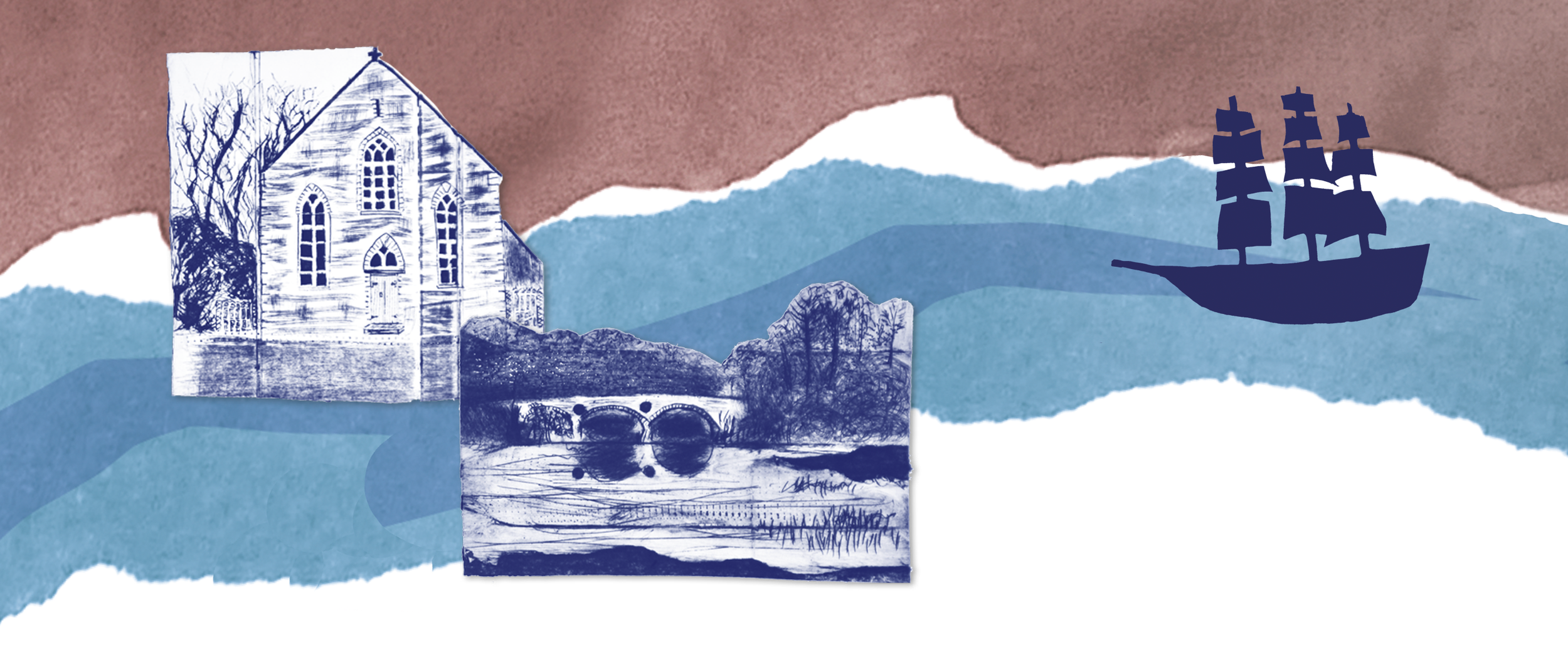
The River Teifi - its past, present and future.
The River Teifi is one of Wales' most iconic waterways. As the longest river that flows entirely within Wales, it is renowned for its rich wildlife, cultural heritage and historical significance. Like many rivers, however, it faces growing pressures from pollution, climate change and unsustainable land use.
About Llais yr Afon
Llais yr Afon is a partnership project led by Small World Theatre in collaboration with spacetocreate, West Wales Rivers Trust and Save the Teifi. The project was supported by The National Lottery Heritage Fund and the Esmée Fairbairn Foundation's Blue Spaces Programme.
Working with communities across the Lower Teifi Valley, Llais yr Afon brought together arts and citizen science. The project began with a pilot schools programme in Cenarth and Llechryd primary schools, inspired by the remarkable Idris Mathias manuscript map created between 1945 and 1962.
During this initial phase, West Wales Rivers Trust also led the development of The People's Plan for the River Teifi - a shared vision for the river's future that prioritises ecological health, sustainable management and community involvement. The plan identified five key themes of public concern: Access, Biodiversity, Food and Farming, Water Quality, and Culture & Heritage.
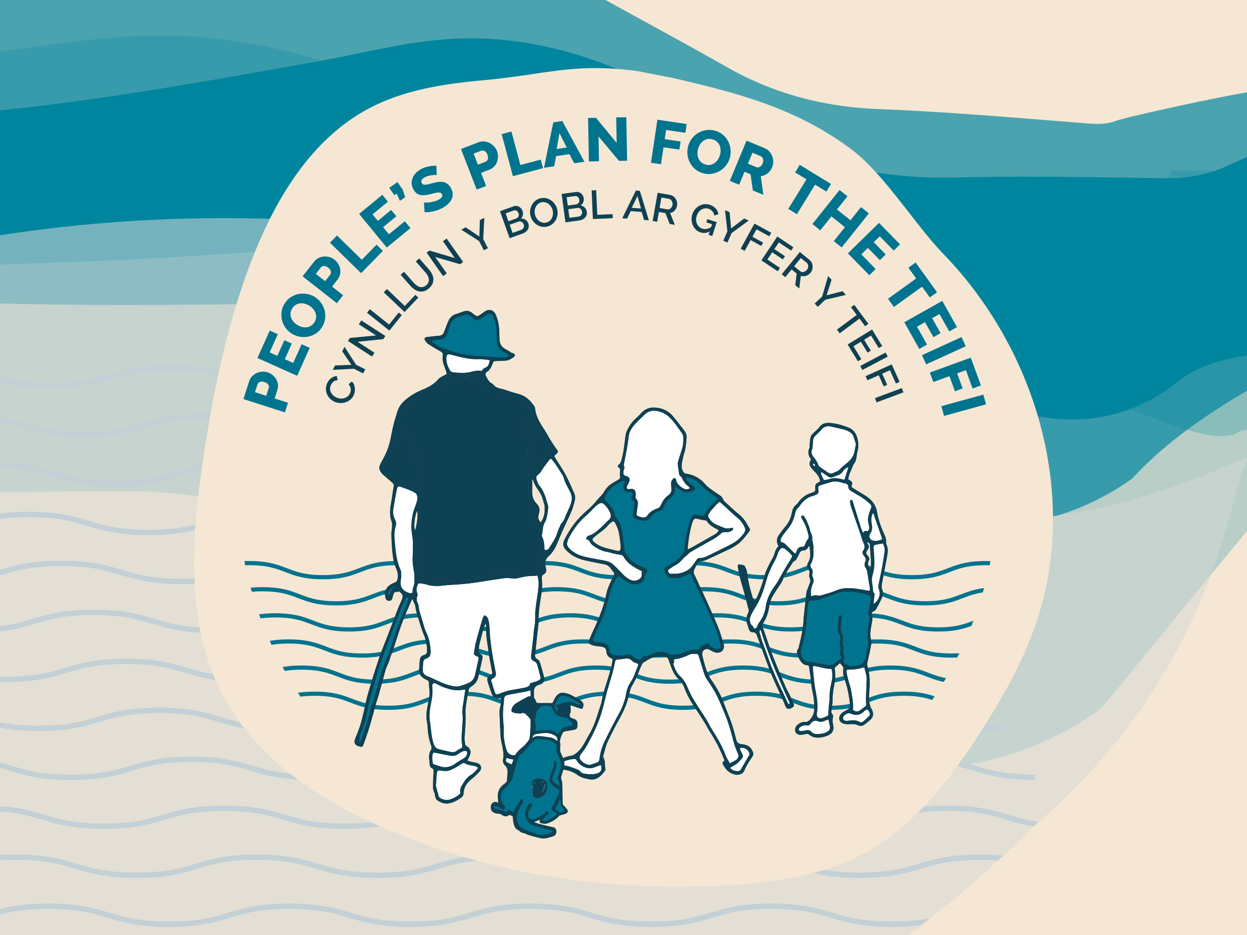
Download the People’s Plan for the Teifi from West Wales Rivers Trust’s website.
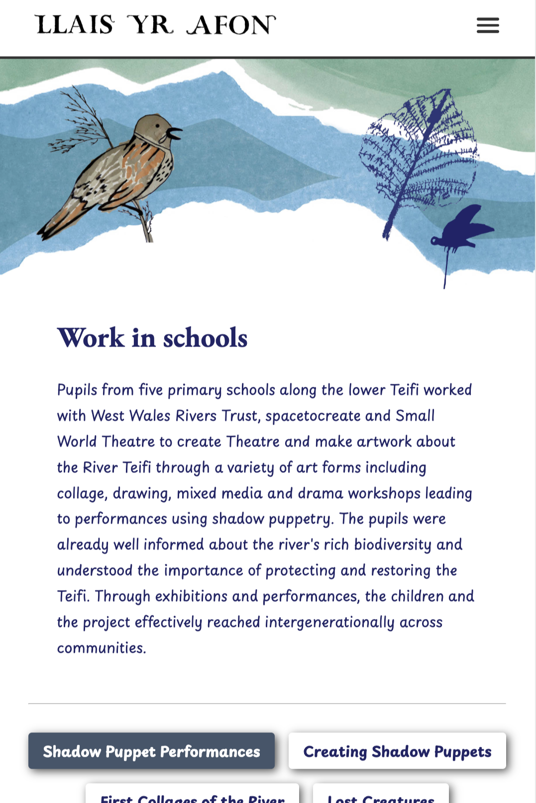
Growing the River Project Across Communities
In the next phase, the programme expanded to schools and communities in Cilgerran, Aberteifi and Llandudoch. As well as delivering a summer programme of community events and festivals that used the themes of The People's Plan to map the river, spark conversations and co-create the visual content for an inspiring contemporary folk map and website.
The new contemporary folk map gives a voice to the river and the people who care for it. It is a lasting resource and a legacy for future generations. The map was exhibited alongside a copy of the Idris Mathias map and toured to the participating schools and communities.
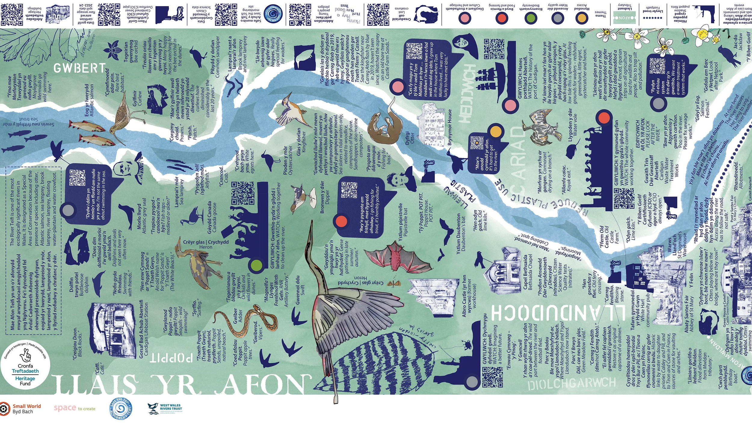
Click on the image to visit the map
Mapping the River 2025. Designed by spacetocreate and Heidi Baker
The Digital Home of the Project
llaisyrafon.cymru is the digital home of the project, preserving its outputs in an accessible and ongoing way. The website features the contemporary map and themed galleries showcasing creative work contributed by the hundreds of people who took part.
Click on the image to visit the website
Designed by Small World Theatre and Steve Knight.
The Legacy
Llais yr Afon brought communities, artists and scientists together to reimagine the future of the River Teifi, building stronger connections to the river and a shared responsibility for its care.
It’s legacy lives on through The People's Plan, a living document shaped by local voices, and a contemporary folk map that will continue to tour. All artworks, resources and research remain freely available online, creating a lasting digital record to inform and inspire future action for a healthy, thriving river.
In November 2025 we commissioned Dr Rowan O'Neill to write about the project.
Rowan is an artist, writer and performance maker from Felinwynt, Ceredigion. Inspired by a rural agricultural up-bringing in a predominantly Welsh speaking community her research and creative practice represent a continuing investigation of language, identity, place and belonging. In 2013 she completed a PhD at Aberystwyth University funded by the Coleg Cymraeg Cenedlaethol. This practice-based thesis, Croesi'r Bar (tr. Crossing the bar) explored the archive of theatre maker Cliff McLucas with a particular focus on his development of 'deep mapping' as a sustainable life practice.
Mapping pasts, mapping futures: a blueprint from the Teifi valley
-
It is December 2025 and the river Teifi is being heralded as river of the month by River Action UK a campaigning organisation “on a mission to rescue Britain's rivers from a toxic cocktail of agricultural, sewage and industrial pollution”. [1] Rivers have become scandalously emblematic of the devastation wreaked by unbalanced and unsustainable anthropocentric life practices. And the River Teifi has been no exception. In August 2022 Ffynnone community resilience held an open meeting for those concerned about water quality in the Teifi following numerous pollution events. As a result of that meeting a community organisation, Save the Teifi was born, campaigning to rescue and restore the Teifi to better ecological health.
In October 2025 Llais y Afon a partnership project between Small World Theatre, spacetocreate, West Wales Rivers Trust and Save the Teifi revealed a new map of the lower Teifi valley presented as, a ‘contemporary folk map’. The map has both a physical and digital presence and brings together past, present and future in a beautifully crafted representation of the river. QR codes connect viewers via their mobile phone to layers of multimedia content including a series of shadow puppet animated films created by primary school children all along the river catchment area, links to citizen science data regarding chemical concentrations in the water and the voices of individuals recording their unique connections to and perspectives on this beloved waterway.
-
The map, a rich and multi-layered document, the culmination of a series of workshops and public events over the past two years, has been created in response to another extraordinary mapping of the river which was undertaken some 70 years previously by the unlikely cartographic partnership of Idris and Beryl Mathias. Working from 1945 on into the early 1960s, this couple from Cardigan created a map documenting every name ascribed to the river’s bank, resident flora and fauna as well as local myths and legends associated with the Teifi starting at the falls at Cenarth flowing through Llechryd, Cilgerran, Cardigan, St Dogmaels through the estuary past Poppit and Gwbert and finally out to the open sea. The previous health of the Teifi finds no better document than this earlier map; a fantastic almanac of Welsh language toponymic detail, a litany of place names, common Welsh names for plants, flowers, birds, mammals, amphibians and fish whose habitat this place was. Along one edge of the map there appears a beautiful schematic of the life cycle of the salmon depicting its transformations from egg to giant sea trout. There are proverbs, connected sayings and poetry indicative of the many storied place that this once fecund and revered river embodied. The map also records the pre-industrial industries of the place testament to a way of life taking place both in and alongside the river.
Genealogies centred on particular properties include Mathias’ own relations depicted as coracle men along the river bank, with out-stretched arms and pointing fingers to sayings such as, ‘Cynta' i law aü lygad’ – ‘before hand and eye’, ‘A dyno Duw a fydd’ - ‘and there God will be’.
Mathias was a postman by occupation, a significant community role which he put to good use in the making of the map. He was able to achieve such depth of detail regarding the river by leaving sheets of blank paper with those who lived at properties along the river bank asking them to sketch and record their knowledge of their particular perspective on the Teifi. He would then collect these sketches on subsequent rounds compiling them, along with his wife Beryl, onto the master map that would then be rolled up and stored under the bed until the next
section could be completed. [2] Place names are tidily stencilled and flora and fauna appear gloriously coloured. There are trees on the river bank and fish in the river and coracles and the men who fish in them. The complete map is 60 feet in length making it difficult to exhibit in its entirety. It appeared briefly in the Corn Exchange at Cardigan’s Guild Hall in 2016 as part of Gŵyl y Cynhaeaf and has been brought to the fore again thanks to the Llais yr Afon project. We are fortunate that the Mathias’ map has now been digitised by the National Library of Wales and through the generosity of the Mathias family is today accessible online. [3]
-
To some the Mathias’ map is a folk map, but to others especially given it’s current digital iteration, it might also take on the aspect of a ‘deep map’, a term which has its own precedence for invocation in the lower Teifi valley. In December 2000 the artist and scenographer Cliff McLucas delivered a lecture at Lampeter University where he posited a kind of manifesto for ‘deep mapping’, a practice that had been nascent in the site-specific works of the theatre company he had been a part of for over a decade, Brith Gof. For McLucas the arrival of publicly accessible digital media was the catalyst for the development of ‘deep maps’, a way, “of combining the best of the landscape picture, other media such as text, diary, sound recording
and moving image, onto a multi-layered ‘map’ that, using digital technologies and media, can create an orchestration of images and voices”. McLucas considered that the idea of the deep map might only be possible – or even imaginable – at this time because of the relative ease with which different types of media can be assembled and combined through digital processes constituting, ‘a new creative space’. [4] McLucas developed his manifesto in a prospectus titled Prosiect Ogam which proposed to create a deep map of the Pembrokeshire coastal path. Here he writes, “Deep maps will be slow – they will naturally move at the speed of landscape or of the weather”. [5] It took nearly seventeen years for the Mathias’ to complete their map of the Teifi.
Again, according to McLucas, “Deep Maps will only be achieved by the use of a variety of media – they will be genuinely multimedia – not as an aesthetic affectation, but as a practical necessity.” [6] The Mathias map was originally drawn on a single roll of cartridge paper.
The role of technological and scientific innovation in driving the development of the practice of mapping is a story at the heart of Rachel Hewitt’s Map of a Nation: a biography of the Ordnance Survey. By co-incidence, it is a story that connects again to the Teifi Valley, through the life of John Colby who, raised by his maternal aunts at Rhos Y Gilwen, grew up to serve as the Ordnance survey’s chief cartographic officer. His trigonometric survey of the British Isles secured the basis on which the topography of the British Isles is imaged and imagined to this day. Moreover, it is in Wales that the OS began to perfect their modus operandi, becoming as Hewitt describes it, ‘a laboratory for toponymic innovation’. [7] During the 1820s working their way from the Wye valley west and then north whilst the country was mapped physically through triangulation, surveyors were also instructed to consult various written sources to gather historical evidence for place name usage and to seek the advice of native Welsh speakers building a library of invaluable reference material. [8] Over the course of the next two decades the country would be mapped entirely so that by the 1840s it was possible for the general public to possess a map of the land.
Hewitt’s narrative account of these early surveys exposes the tension between aesthetics and utility in the creation of maps in an episode focused on Trellech Beacon, a high point above the west bank of the River Wye. It is this river valley which offered itself as a gateway to the initial survey of Wales on which subsequent maps would be based. Arriving here Colby was following in the footsteps of a Cumbrian clergyman, William Gilpin, originator of the idea of the ‘picturesque’, a notion of the beauty of landscapes deemed agreeable in a picture. Such a picturesque landscape was embodied for Gilpin by this particular stretch of the Wye valley. Whereas a surveyor such as Colby would prioritise quantification and detailed analysis those seeking the picturesque would regard the terrain from its ability to elicit spontaneous emotion stating, ‘we rather feel, than survey’ the terrain. [9] Trellech Beacon was nonetheless a gateway for the Ordnance Survey’s advance deep into Cymru. [10]
A key motivation for McLucas’ development of the concept of ‘deep mapping’ was his overriding concern for the erasure of the Welsh language. For him the deep map was an act of cultural visualisation, specifically Welsh language culture, as he wrote, “…any process of visualisation of this culture that has, as far as Britain is concerned, been ‘underground’ or private, has to deal with the place that this culture inhabits – both geographical and emotional (dare I say ‘spiritual’?)” [11]. It is hard not to feel emotional in the presence of the Mathias’ map – to think of the hours that were spent collecting the names and painstakingly recording and reproducing them. It is quite possible to also read their project as a spiritual one given the heliocentric ‘Croes Roesog’ Rosicrucian cross and druidic imagery as the river gives way to the sea. What was it that prompted the Mathias’ to toil at their unambiguous, unashamed Welsh map? Was it indeed a similar concern to McLucas, a desire to safeguard precious cultural knowledge in the face of the change that rapid technological and industrial advancements would stamp on their post war society. The Mathias map is a dizzying artefact. It can be read from all sides and angles and bears several titles; at the sea end, above the cross is writ large in capital letters AT LLANT IS. At first reading I took this to be a play on the word Atlantis, the mythical lost undersea world, but a translation from Welsh would render it, ‘for younger children’. The map is magical, mythical, fairy-tale fable like and, both from our 21st century viewing and their mid 20th century making, properly nostalgic. Llwybraidd y nos – the night paths – lead the coraclers to Plwy-y- Pysgod the parish of the fish, the rich pickings, the salmon for which the river was famed and had come to be relied upon.
When we think of the early activities of the Ordnance Survey it is hard to dissociate their activities with extractive colonialism; the documentation of land in order to aid possession and resource exploitation a theme of Brian Friel’s landmark play, Translations. An online blog written by Seth Johnson-Marshall of the West Wales Rivers Trust relates a report from an early 20th century commentator on the Teifi which asserted that at the mid-point of the nineteenth century, in proportion to the river’s size, more nets were used on the Teifi than any other river in England and Wales with salmon and trout juveniles being sold by the pound for just pennies. As a result of this practice he records that by 1868, the rod fishery on the river had collapsed. In an attempt to kerb this hyper exploitation, a plan was devised to blow up Cenarth falls as a way to ease the upward passage of the river for the fish to return to spawn. The plan was strongly opposed; workmen were stoned by locals who protested the destruction of the naturally occurring pool that provided easy pickings for coracle fishers and full nets. [12]
According to artist, arts educator and long-standing champion of the potential uses of deep mapping Iain Biggs, “Deep mapping aims, broadly speaking, to engage with, narrate and evoke ‘place’ in temporal depth by bringing together a multiplicity of voices, information, impressions and perspectives as a basis for a new connectivity.” [13] A deep map according to McLucas is a highly collaborative form of working that brings together the professional and the amateur, artist and scientist, cultural producer and farmer. [14] In these terms the act of mapping rather than fuelling the pursuit of unsustainable extraction and the exploitation of resources can be viewed as a tool capable of extraordinary acts of social representation. The Llais yr Afon
project’s mapping of the lower Teifi valley whilst directly inspired by the Mathias map contains elements of both the Mathias’ and McLucas’ working practices. In addition to the printed and digital map an abstracted version has been fashioned at a smaller scale as a series of postcards harking back to both Idris Mathias’ occupation and his method of data collection. Idris Mathias the postman might well have delivered a set of these postcards to river residents in an attempt to verify the details he wanted to record. These images have also been re-produced in the form
of wall length fabric banners bringing to mind a favoured medium of McLucas whose series of banners representing the books of the Old Testament were displayed outdoors in the village of Llanrhaeadr y Mochnant during the 400th anniversary of William Morgan’s translation of the Bible into Welsh. He would go on to work at a similar scale when working on a project at Stanford University, a deep map of the San Andreas fault, where he set out to painstakingly map the lost languages of native American peoples alongside the casualties of devastating earthquakes, the natural disaster that the fault line originates.
-
During the covid pandemic the containment of people’s lives to their immediate surroundings and the need for daily exercise brought into relief the current state of our local landscapes, an unforeseen consequence perhaps of people’s opportunity to re-connect with their square mile. It is in this context that the Llais yr Afon project came into being. Inspired by increasing concern for the current state of the same water-way that the Mathias map depicts, this new map follows the impulse of the original map re-animating it’s spirit in our current bilingual age with the ability of our time to harness digital technologies in order to layer and juxtapose image and
data. Image and text co-inhabit the map - there is no hierarchy to the information collated around the themes of; access, biodiversity, food and farming, culture and heritage and water quality. As such the map takes on another quality of a McLucas deep map; it is a conversation and not a statement. [15]
Llais yr Afon has coincided with other river projects locally each with a different mode of enquiry; the artist collective Maynard’s deep river listening [16], inspired by the work of composer and sound artist Pauline Oliveros, invited a multi-disciplinary group of artists to the Cych valley to engage with the river from the perspective of each artist’s own particular practice. Nyfer am Byth [17] has worked to create a community plan for the afon Nyfer engaging in citizen science and raising awareness of the challenges associated with this water’s particular catchment area. Llais yr Afon has elements of both these approaches with a particular emphasis on engaging younger people, empowering future generations with the knowledge to care for the well-being of their environment. When McLucas writes about Welsh language culture underground it is not too far a stretch to think of the river underground; as water courses throughout the land have historically been canalised or built over obscured, erased or kept from view. On the Llais yr Afon contemporary map the biggest barrier preventing people engaging with the river is recorded to be a lack of clear access to the river. The image of something driven underground conjures for me the image of the bodies of water that though seemingly disappeared and dried up can, given the right conditions be suddenly filled to the brim again, teeming with fast flowing
water, oxygen and life that Amy-Jane Beer writes about so vividly in her work, Flow. She demonstrates that sites of destruction can also be the beginning of something new.
Towards the end of her book Beer reflects on how the current degradation of our rivers can be reversed. She writes of contemporary campaigns seeking to apply the concept of legal personhood to our rivers giving rivers rights beyond the demands of a human resource. She also points to the growing importance of non-state activity; that is public reporting of breaches that would endanger river health noting that for such reporting to be effective it requires a public knowledgeable enough to know when something is wrong and motivated enough to act. [18] The full potential of the deep map remained for McLucas something that could only be imagined. He died shortly after returning from California leaving his deep mapping manifesto a powerful provocation. Curiously, at the point within his proposal where he begins to describe the
physical act of making a ‘deep map’ there is a tacit acceptance that such mapping projects, by their very nature, will remain unfinished,
I can imagine Deep Maps having three basic elements – a large scale real world horizontal graphic work under constant development on the floor of a public building that is accessible by all, a time-based video representation onto which new layers and new information can be added, and a database dependent archival system such as GIS that also remains open-ended and unfinalised. [19]
A tantalising aspect of the Mathias map is its unfinishedness both in the knowledge of the Teifi water body that continues up-stream from Cenarth as far as the Ceredigion uplands and a surprising depiction of the estuary at Newport, the mouth of the river Nyfer, orphaned from its river body that rises at Frenni Fawr beyond the Preseli hills in Pembrokeshire. At the end of McLucas’ mapping manifesto, as first revealed during his presentation at Lampeter University, there also hangs an orphaned phrase,
‘…the future of technology is desire’...
Rowan O'Neill, Aberteifi, Chwefror 2026
-
It is February 2026 and a headline from the Tivyside, a newspaper that styles itself the voice of the lower Teifi valley for the last 150 years reads, ‘Nature at tipping point’.
[21] The article that follows announces details from the latest report by Natural Resources Wales into the state of Wales’ natural environment. The report discloses that Salmon are expected to disappear completely from some Welsh rivers by 2030, with just 40 percent of water bodies in Wales being classed in good condition. Throughout the report there are warnings of data gaps and the need for further monitoring. Against this backdrop the Llais yr Afon map offers itself as an exemplar technology; gathering the resources needed to respond to environmental change; “ecologies of knowing, feeling and experience”. [22] In these circumstances projects like Llais yr Afon must contribute to, “the social, economic and cultural transformations necessary for a new ecological order”. [23] Without the river there can be no garden. In Cumbria a recent National Lottery funded project, Access to Eden: breaking barriers, building bridges seeks to remove the barriers that prevent people and wildlife from accessing the natural heritage of East Cumbria and ‘build the bridges’ needed so that both human and non-human can continue to live and thrive in, on and beside Eden’s rivers. Core to this project, led by the Eden Rivers Trust, is a desire to create an organic community conservation network for the Eden operating across organisational boundaries where ideas, knowledge, and opportunities flow easily from one site to the next. [24] The future of technology is desire...
By Dr Rowan O'Neill, Aberteifi, Chwefror 2026.
-
1 https://riveractionuk.com/news
2 Information gathered in conversation with Guy Norman of Llais yr Afon project partner spacetocreate
3 https://www.library.wales/discover-learn/digital-exhibitions/maps/idris-mathias-manuscript-map-of-thelower-teifi-valley
4 Aberystwyth, Llyfrgell Genedlaethol Cymru, Casgliad Cliff McLucas, MG2/1 I was invited to this island
5 Aberystwyth, Llyfrgell Genedlaethol Cymru, Casgliad Cliff McLucas, MP2/1 Prospectws Prosiect Ogam
6 Ibid
7 Hewitt, Rachel, Map of a nation: a biography of the Ordnance Survey (Granta, 2011), p. 193
8 Op. cit. pp. 193-4
9 Op. cit. p. 186
10 Op cit. p. 182
11 Aberystwyth, Llyfrgell Genedlaethol Cymru, Casgliad Cliff McLucas, MP2/1 Prospectws Prosiect Ogam
12 Information recorded in an online blog by Seth Johnson-Marshall of the West Wales Rivers Trust
https://www.wildtrout.org/wttblog/the-story-of-a-river
13 Biggs, Iain, ‘The Spaces of Deep Mapping: a partial account’ in Journal of Arts and Communities Vol, 2 Iss 1
June 2011, p. 11
14 Aberystwyth, Llyfrgell Genedlaethol Cymru, Casgliad Cliff McLucas, MP2/1 Prospectws Prosiect Ogam
15 Aberystwyth, Llyfrgell Genedlaethol Cymru, Casgliad Cliff McLucas, MP2/1 Prospectws Prosiect Ogam
16 https://www.may-nard.org/afon-deep-listening
17 https://www.nyferambyth.cymru/
18 Beer, Amy-Jane, Flow: rivers, water and wildness (Bloomsbury, 2023), pp.334/338
19 Aberystwyth, Llyfrgell Genedlaethol Cymru, Casgliad Cliff McLucas, MP2/1 Prospectws Prosiect Ogam
20 Aberystwyth, Llyfrgell Genedlaethol Cymru, Casgliad Cliff McLucas, MG2/1 I was invited to this island
21 Tivyside Advertiser, Tuesday 3 February 2026, p.20
22 Biggs, Iain, ‘The Spaces of Deep Mapping’, in Journal of Arts & Communities, Volume 2, Issue 1, Jun 2011, (pp. 5 – 25), p. 19
23 Op. cit. p. 6
-
Amy-Jane Beer, Flow: Rivers, Waters and Wildness
Iain Biggs, The Spaces of Deep Mapping: a partial account
Rachel Hewitt, Map of a Nation: A Biography of the Ordnance Survey
Cliff McLucas, Prosiect Ogam: Rhwng ei dau fon
Anwen Jones & Rowan O’Neill, Living Maps of Wales: Cartography as inclusive cultural practice in the works of Owen Rhoscomyl and Cliff McLucas